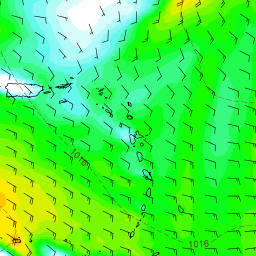
6 Jul 1100
11am NHC update. Still expected to be not 'Don'.
Dry air and shear said to be too much.
.....
Tropical depression number 4 latest update
Right now its starting to feel effects of dry air ahead of it as you can see the orange shades around the system indicates dry air and these systems need moist air in order to survive..please see update from nhc below.
5 jul 1000
Invest 94 starting to get some convection these past several hours. Still has obstacles ahead that models keep showing down the road. NHC locked in at 70% chance it will be a TD/TS soon.
Circulation is there.. just needs more thunderstorms and we may have a go. If it survives models showing high pressure bending it more west closer to the states...
BUT that is if it even has anything left.
Timing would be just east of the Bahamas this time next week. www.spaghettimodels.com / Mikes Weather Page APP
Afternoon jul 4
pressure seems of.. its turning even more north .. predictions..
Morning jul 4
Invest 94 continues to slowly makes its way westward. NHC up to 80% this AM and we could be looking at future Don soon. Models have been consistent on a WNW movement. Still needs to break free from the monsoon trough. High pressure strength will be a big factor on when/if a turn before the US and any islands before. Some weakening nearing the Bahamas has been showing up with a chance to come back after (mainly EURO). No talk on conditions that far ahead from the NHC just that things in the immediate future could enable intensification. Lots to watch. Pictured here are the latest model runs of the EURO/GFS/GFS-P/CMC in 9-days. www.spaghettimodels.com / Mikes Weather Page APP
https://www.windy.com/?2017-07-08-21,15.433,-54.624,6,a:CziIF
right bottom u can choose GFS 'model' (more north) or ECMWF (more west/+way less)
Monday 0900..
Invest 94 out in the Atlantic. Several days away before nearing the Lesser Antilles (current runs pass more to the north of them). Lots to watch. www.spaghettimodels.com
Prediction 3 jul.. hmm some options closer to SXM then yesterday..
Prediction 2 jul... good, every option well clear of sxm..
http://www.ssd.noaa.gov/goes/east/tatl/wv-animated.gif
http://www.ssd.noaa.gov/goes/east/tatl/rb-animated.gif
http://www.ssd.noaa.gov/PS/TROP/floaters/94L/94L_floater.html
3 jul Will Azores High push it down??
2 jul
The prediction (only GFS) now, Sat Jul 1/7,
is that this will pass SXM next Saturday 8/7
ca 200nm East,
moving sort of NW...
If so.. should be no problem,,,, Just a day with no wind turning anti clockwise around, gray and rain..
Sat 8 Jul 1200
SXM to Grenada (380nm or 700km) is normally 2-3 days with 15knts East wind..
update.. on Monday morning prediction for Sat 7 jul.. system more east.. looks beter..
Sun 9 Jul 0800

update.. on Monday morning prediction for Sun 8 jul.. system more north.. also looks better..


No comments:
Post a Comment